
This article provides various tabular data that shows different districts of Nepal by the Provinces. Each section contains overall highlights, map of the province and a list of districts included in each Province with additional information on Total Area and estimated Total population.
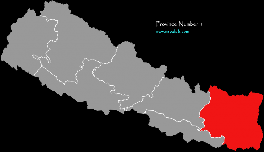
Districts of Province 1
| Total Districts: | 11 |
| Total Area: | 25,905 |
| Total Population: | 4,534,943 |
| District | Headquarters | Area (km2.) | Population (2011) |
| Taplejung District | Taplejung | 3,646 | 127,461 |
| Panchthar District | Phidim | 1,241 | 191,817 |
| Ilam District | Ilam | 1,703 | 290,254 |
| Jhapa District | Bhadrapur | 1,606 | 812,650 |
| Morang District | Biratnagar | 1,855 | 965,370 |
| Sunsari District | Inaruwa | 1,257 | 763,487 |
| Dhankuta District | Dhankuta | 891 | 163,412 |
| Terhathum District | Myanglung | 679 | 101,577 |
| Sankhuwasabha District | Khandbari | 3,480 | 158,742 |
| Bhojpur District | Bhojpur | 1,507 | 182,459 |
| Solukhumbu District | Dudhkunda | 3,312 | 105,886 |
| Okhaldhunga District | Siddhicharan | 1,074 | 147,984 |
| Khotang District | Diktel | 1,591 | 206,312 |
| Udayapur District | Triyuga | 2,063 | 317,532 |
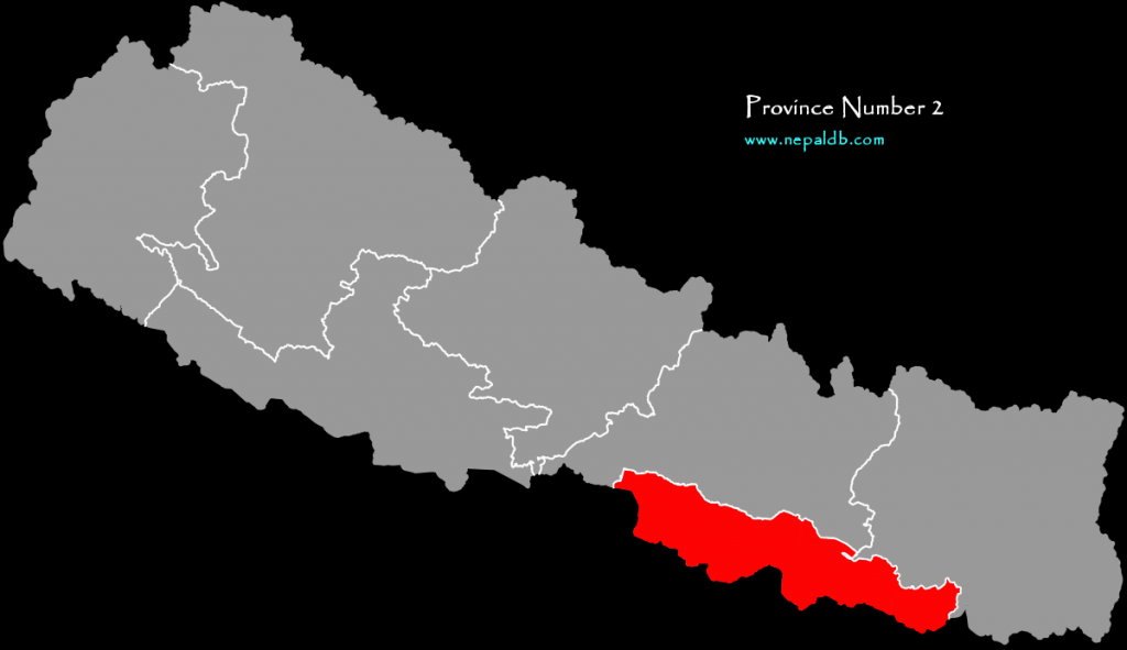
Districts of Province 2
| Total Districts: | 8 |
| Total Area: | 9,661 |
| Total Population: | 5,404,145 |
| District | Headquarters | Area (km2.) | Population (2011)[6] |
| Saptari District | Rajbiraj | 1,363 | 639,284 |
| Siraha District | Siraha | 1,188 | 637,328 |
| Dhanusa District | Janakpur | 1,180 | 754,777 |
| Mahottari District | Jaleshwar | 1,002 | 627,580 |
| Sarlahi District | Malangwa | 1,259 | 769,729 |
| Bara District | Kalaiya | 1,190 | 687,708 |
| Parsa District | Birganj | 1,353 | 601,017 |
| Rautahat District | Gaur | 1,126 | 686,722 |
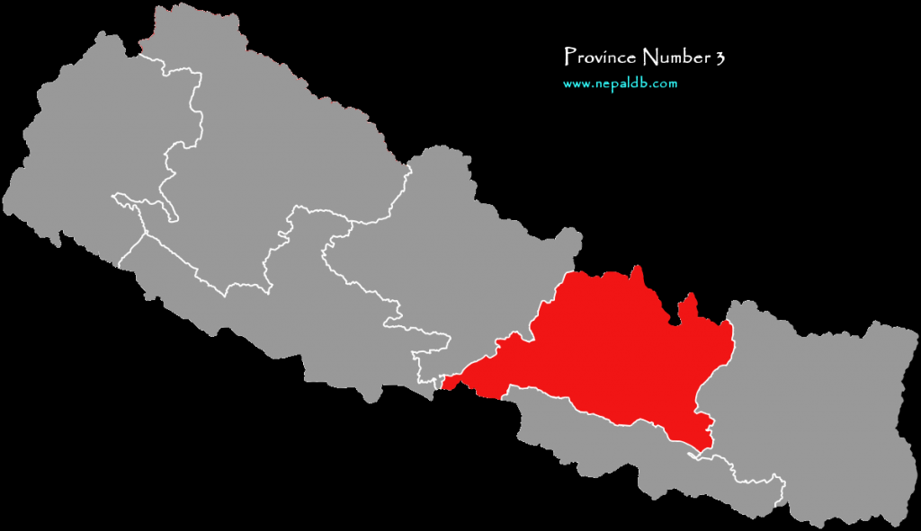
Districts of Province 3 (Bagmati Pradesh)
| Total Districts: | 13 |
| Total Area: | 20,300 |
| Total Population: | 5,529,452 |
| District | Headquarters | Area (km2.) | Population (2011) |
| Sindhuli District | Kamalamai | 2,491 | 296,192 |
| Ramechhap District | Manthali | 1,546 | 202,646 |
| Dolakha District | Bhimeshwar | 2,191 | 186,557 |
| Sindhupalchok District | Chautara | 2,542 | 287,798 |
| Kavrepalanchok District | Dhulikhel | 1,396 | 381,937 |
| Lalitpur District | Lalitpur | 385 | 468,132 |
| Bhaktapur District | Bhaktapur | 119 | 304,651 |
| Kathmandu District | Kathmandu | 395 | 1,744,240 |
| Nuwakot District | Bidur | 1,121 | 277,471 |
| Rasuwa District | Dhunche | 1,544 | 43,300 |
| Dhading District | Nilkantha | 1,926 | 336,067 |
| Makwanpur District | Hetauda | 2,426 | 420,477 |
| Chitwan District | Bharatpur | 2,218 | 579,984 |
Districts of Province 4 (Gandaki Pradesh)
| Total Districts: | 11 |
| Total Area: | 21,466 |
| Total Population: | 2,403,757 |

| District | Headquarters | Area (km2.) | Population (2011) |
| Sindhuli District | Kamalamai | 2,491 | 296,192 |
| Ramechhap District | Manthali | 1,546 | 202,646 |
| Dolakha District | Bhimeshwar | 2,191 | 186,557 |
| Sindhupalchok District | Chautara | 2,542 | 287,798 |
| Kavrepalanchok District | Dhulikhel | 1,396 | 381,937 |
| Lalitpur District | Lalitpur | 385 | 468,132 |
| Bhaktapur District | Bhaktapur | 119 | 304,651 |
| Kathmandu District | Kathmandu | 395 | 1,744,240 |
| Nuwakot District | Bidur | 1,121 | 277,471 |
| Rasuwa District | Dhunche | 1,544 | 43,300 |
| Dhading District | Nilkantha | 1,926 | 336,067 |
| Makwanpur District | Hetauda | 2,426 | 420,477 |
| Chitwan District | Bharatpur | 2,218 | 579,984 |
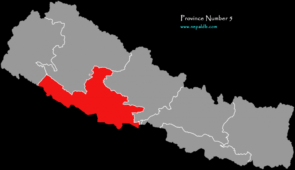
Districts of Province 5
| Total Districts: | 12 |
| Total Area: | 19,114 |
| Total Population: | 4,499,272 |
| District | Headquarters | Area (km2.) | Population (2011) |
| Gulmi District | Resunga | 1,149 | 280,160 |
| Palpa District | Tansen | 1,373 | 261,180 |
| Parasi District | Ramgram | 634.88 | 331,904 |
| Rupandehi District | Siddharthanagar | 1,360 | 880,196 |
| Kapilvastu District | Kapilvastu | 1,738 | 571,936 |
| Arghakhanchi District | Sandhikharka | 1,193 | 197,632 |
| Pyuthan District | Pyuthan | 1,309 | 228,102 |
| Rolpa District | Liwang | 1,879 | 224,506 |
| Eastern Rukum District | Rukumkot | 1,161.13 | 53,184 |
| Banke District | Nepalganj | 2,337 | 491,313 |
| Bardiya District | Gulariya | 2,025 | 426,576 |
| Dang District | Tribhuwannagar | 2,955 | 552,583 |
Districts of Province 6 (Karnali Pradesh)
| Total Districts: | 10 |
| Total Area: | 30,209 |
| Total Population: | 1,570,419 |
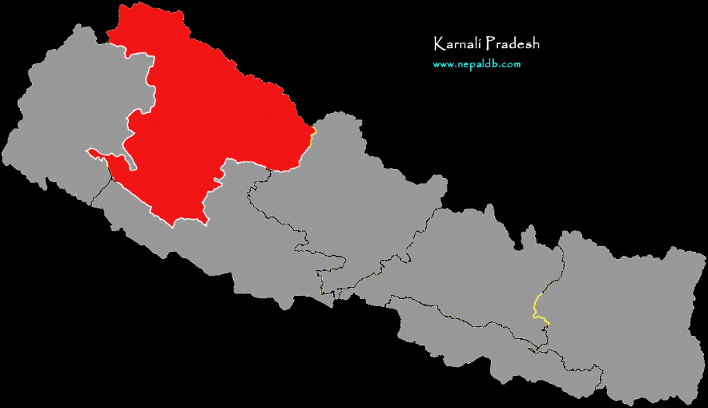
| District | Headquarters | Area (km2.) | Population (2011) |
| Western Rukum District | Musikot | 1,213.49 | 155,384 |
| Salyan District | Salyan | 1,462 | 242,444 |
| Surkhet District | Birendranagar | 2,451 | 350,804 |
| Dailekh District | Narayan | 1,502 | 261,770 |
| Jajarkot District | Khalanga | 2,230 | 171,304 |
| Dolpa District | Dunai | 7,889 | 36,700 |
| Jumla District | Chandannath | 2,531 | 108,921 |
| Kalikot District | Manma | 1,741 | 136,948 |
| Mugu District | Gamgadhi | 3,535 | 55,286 |
| Humla District | Simikot | 5,655 | 50,858 |
Districts of Province No. 7 (Sudur Pashchim Pradesh)
| Total Districts: | 9 |
| Total Area: | 19539 |
| Total Population: | 2552517 |
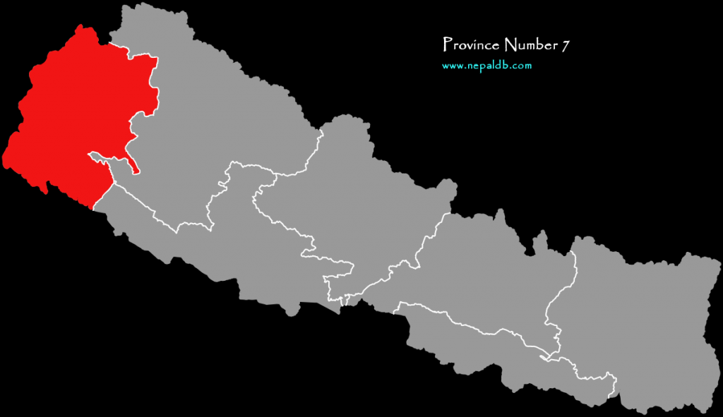
| District | Headquarters | Area (km2.) | Population (2011) |
| Bajura District | Martadi | 2,188 | 134,912 |
| Bajhang District | Jayaprithvi | 3,422 | 195,159 |
| Achham District | Mangalsen | 1,680 | 257,477 |
| Doti District | Dipayal Silgadhi | 2,025 | 211,746 |
| Kailali District | Dhangadhi | 3,235 | 775,709 |
| Kanchanpur District | Bhimdatta | 1,610 | 451,248 |
| Dadeldhura District | Amargadhi | 1,538 | 142,094 |
| Baitadi District | Dasharathchand | 1,519 | 250,898 |
| Darchula District | Api | 2,322 | 133,274 |
1 thought on “Districts of Nepal by Provinces With Area and Population”